The first section of the London Underground opened in 1863. Over the following decades, a number of Tube maps – showing an uncoordinated network of lines owned by different companies – were published in increasing, unwieldy profusion. None looked like the iconic map so beloved by visitors and locals today.
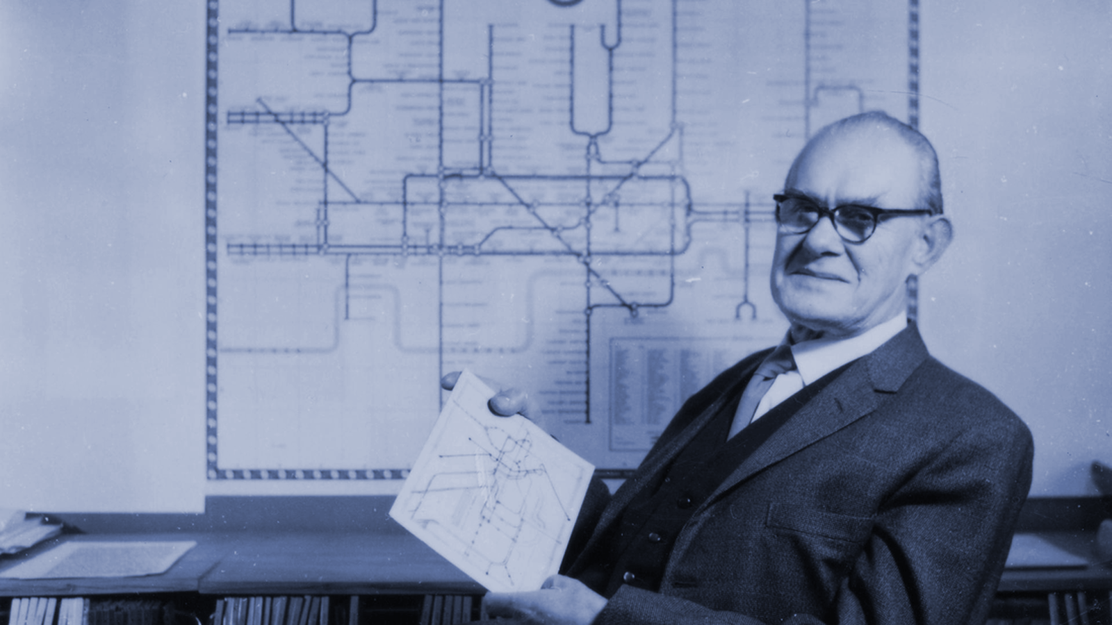
The fact that there were so many Underground maps before Harry Beck’s famous ‘diagram’ of 1931 – the blueprint of today’s maps – was proof of a problem that took many years and a great deal of ingenuity to solve. After all, how could a designer fully represent lines that criss-crossed a few squares miles of central London yet also stretched across what, until as late as 1900, had been farmlands, markets gardens and remarkably remote Middlesex villages? And how could it all fit onto a single map – one that could be folded neatly into a coat pocket?